Archaeological Fieldwork & Visualisations
Role: Fieldwork Assistance, Lidar & Photogrammetry recording, Archaeological Illustrations, Archival Interpretive Artworks
Undertaken in partnership with the University of Sydney’s Pella Project, Jordan and OzArk EHM
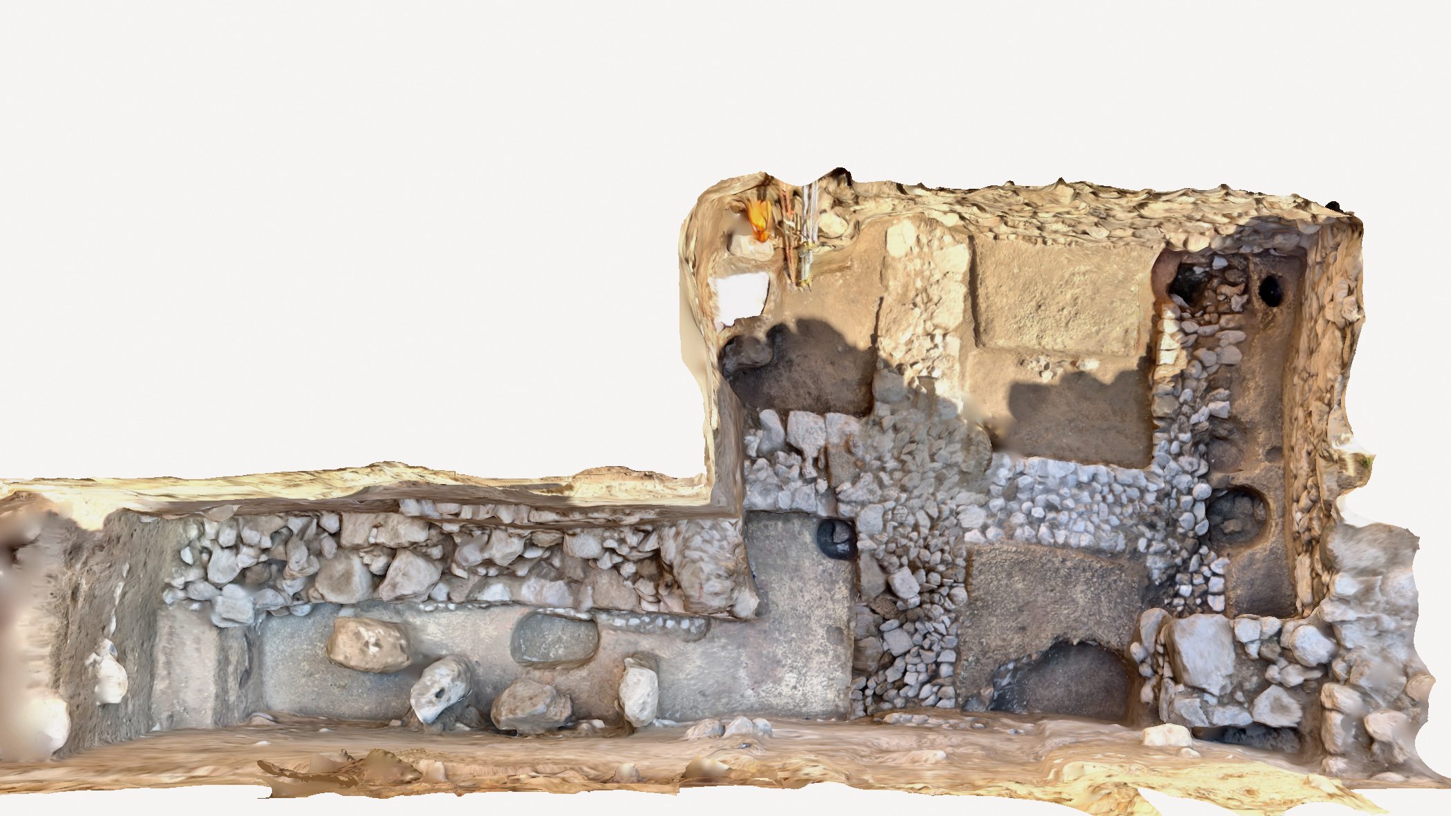
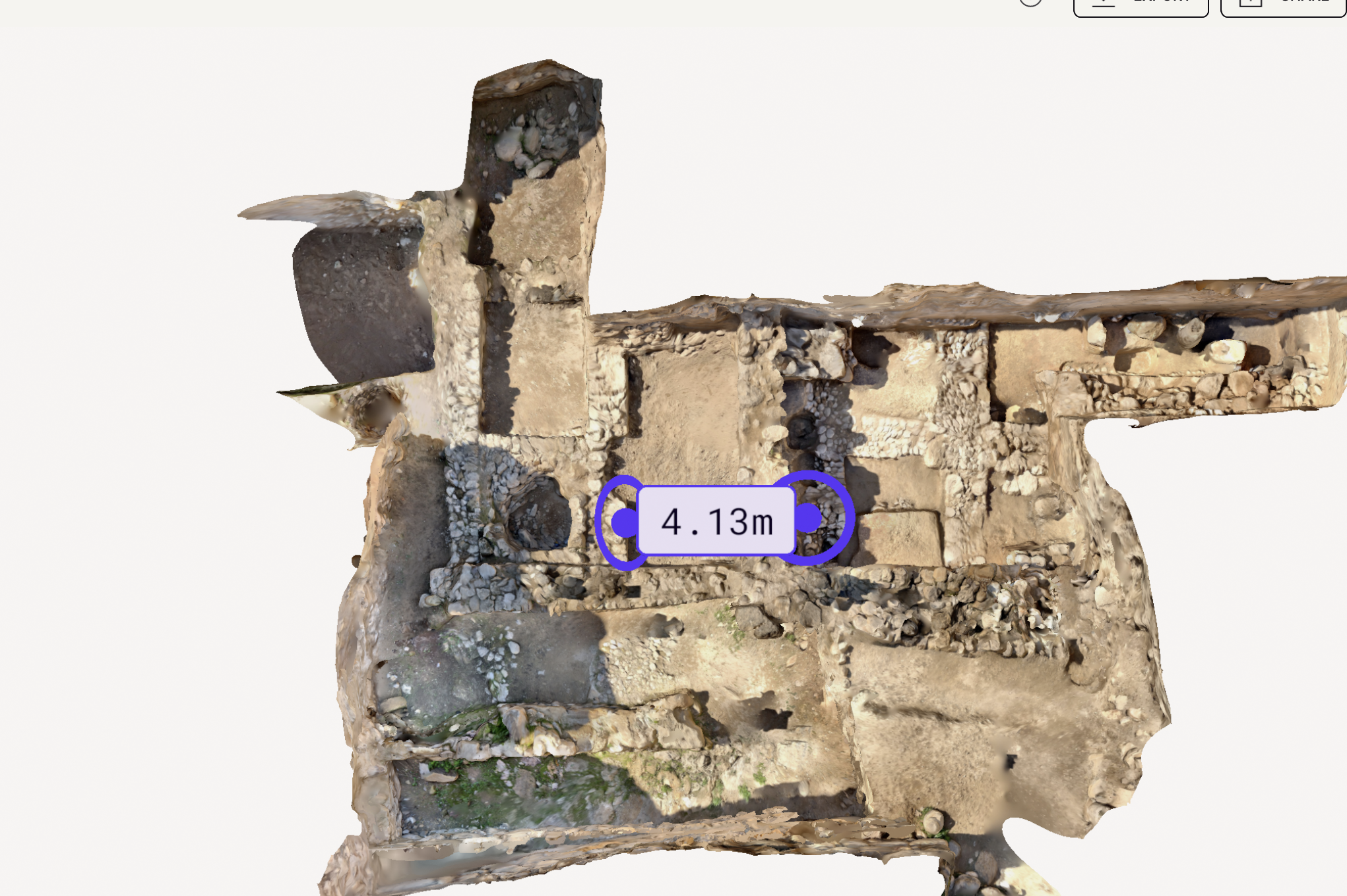
Fieldwork Recordings
The use of Lidar & Photogrammetry in the field allows for archival 3D recordings of sites and artefacts. I use a method that enables on the spot processing, allowing measurements to be taken from the scans while still in the field. Sometimes these measurements are virtually impossible to ascertain in any other way. The 3D models and blueprints are easily shared and snapshot images can be taken from any angle.
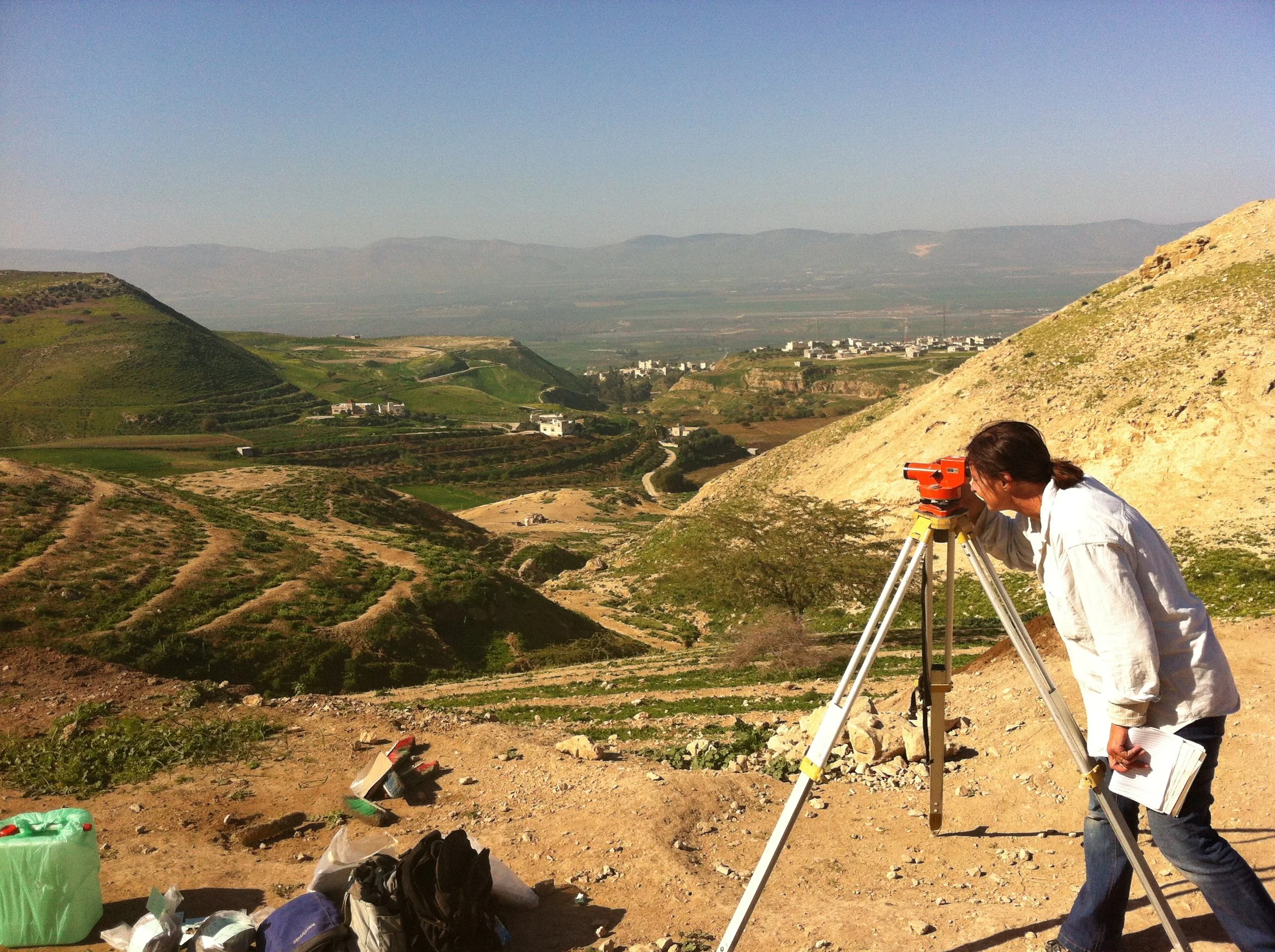
Fieldwork and Report Writing
I am very comfortable working in the field (either in Australia or Internationally) and have assisted archaeologists on various occasions. I have experience with data recording and entry, report writing and liaising with community representatives and external stakeholders. I’m always respectful of cultural customs.
Archaeological Illustration
I have worked as a freelance archaeological illustrator since 2009. Most of the illustrations are completed in the field (in Jordan) using traditional illustration techniques (Rotring pen and paper). I illustrate pottery, small finds and lithics for publication and archival records.
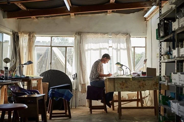

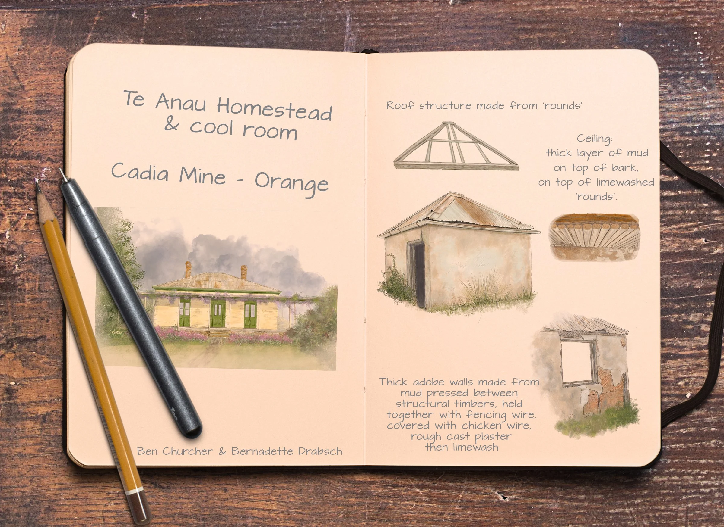
Interpretive Art
I have been commissioned to undertake archival illustrated recordings in situations where photography was not possible or suitable. These have included the Te Anau Homestead and cool room at Cadia Mine, Orange.
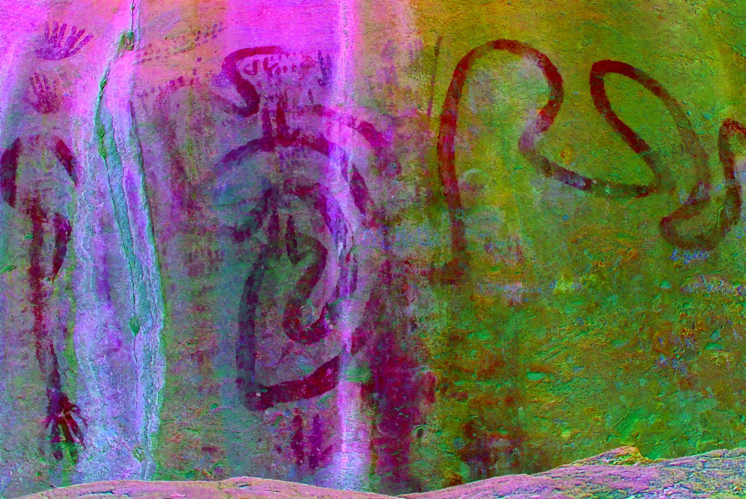
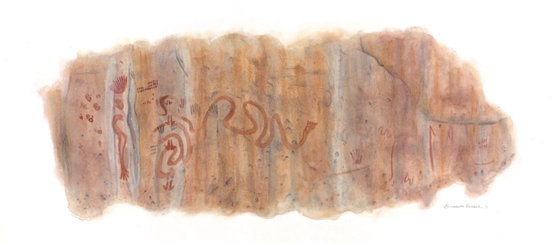
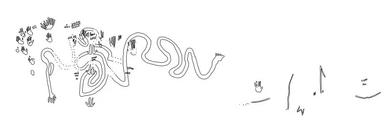
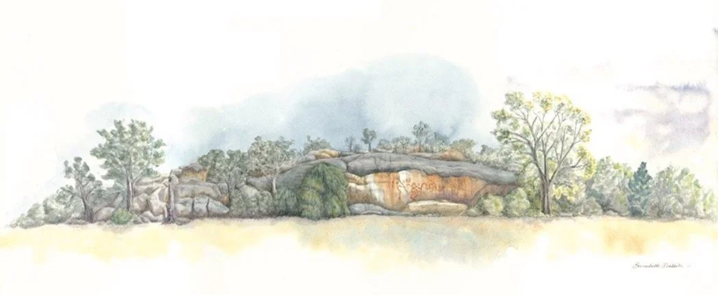
Rock Art Recording
I have been commissioned to produce archival records of Indigenous Rock Art sites in NSW. I use non-intrusive methods of capture and create either illustrated outcomes or enhanced photography (using D-Stretch).