The Darling/Baaka Geotrail App
Role: Co-author, Field Assistant, Post-Production Video Editor
Co-created in Partnership with Department of Regional NSW, Mining Exploration and Geoscience Division
Unique Geology. Engaging App
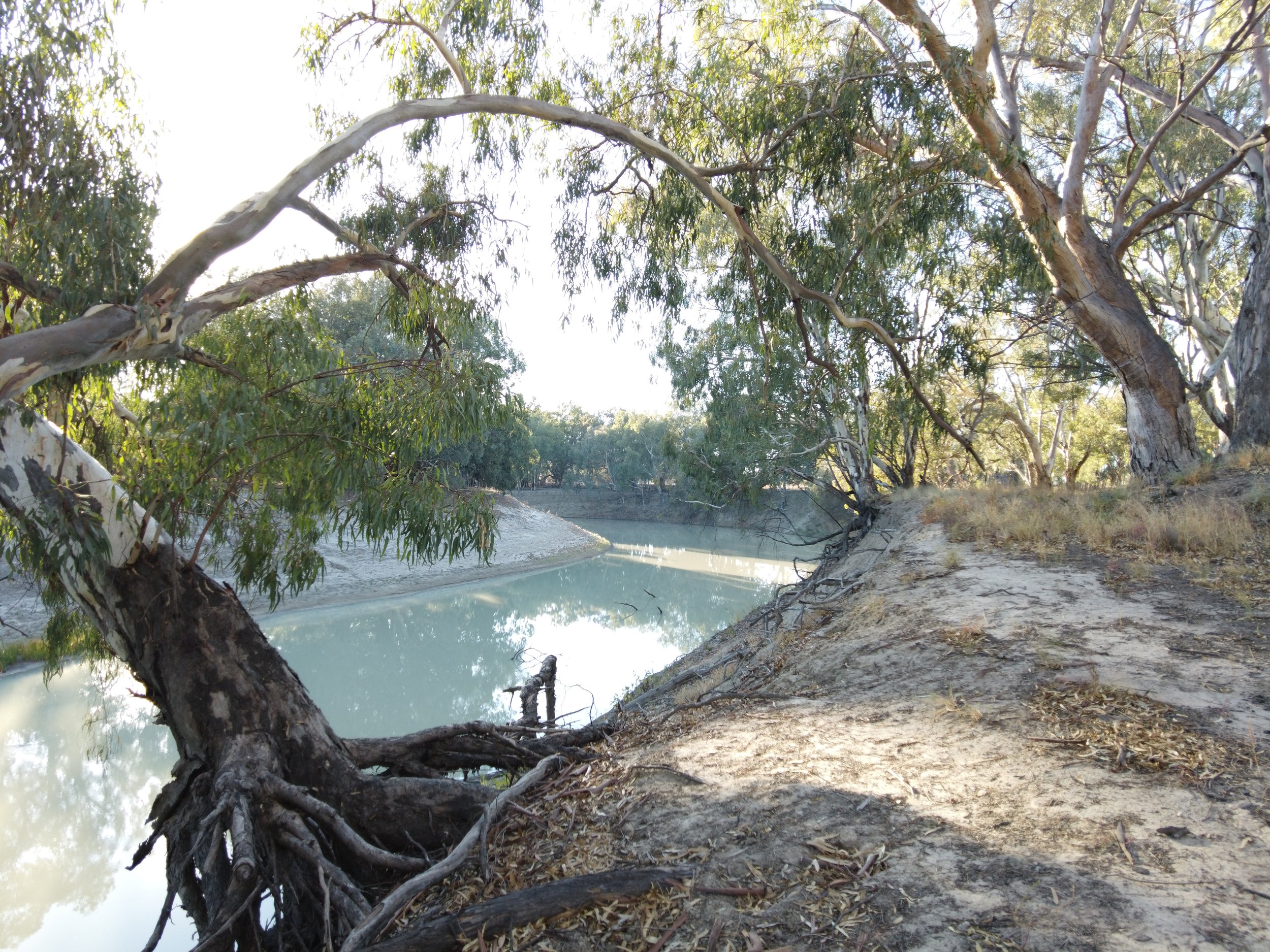
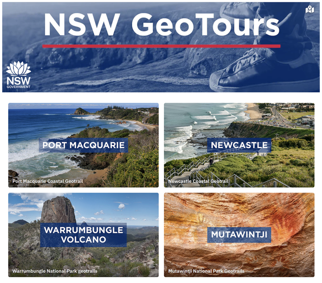
The Darling/Baaka Geotrail App, which is currently under construction, will focus on the geologically fascinating Darling/Barka River system. The App follows on from the NSW Government’s successful Geotours based in Newcastle, Port Macquarie, Warrumbungles National Park and Mutawintji National Park. The free GPS based apps were made in collaboration between the Department of Regional NSW’s, Geological Survey of NSW team and the University of Newcastle’s Earth Sciences Professor Ron Boyd.
Accessible and Engaging Science
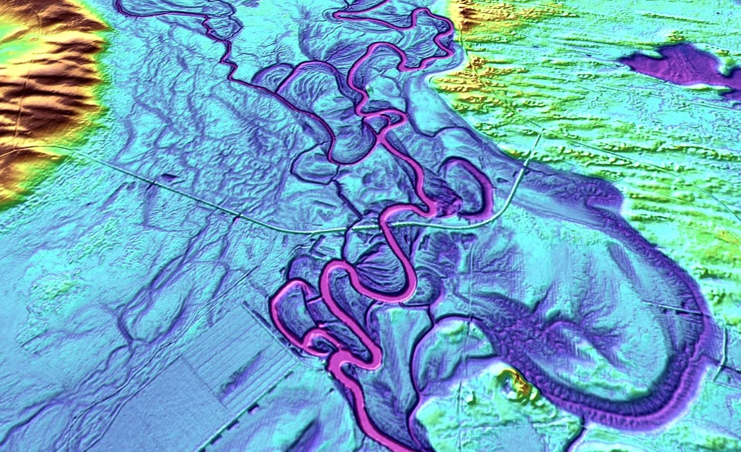
The Darling/Barka Geotrail will be a self-drive tour along Australia’s longest river, The Darling. It will feature podcasts, videos, photography, maps, drone footage and coloured Lidar imagery, accompanied by historical and Indigenous contextual information. The Geotrail follows the Darling/Barka River and also includes Mungo National Park, Kinchega National Park, White Cliffs and the Paroo-Darling National Park.
Co-Creation
My colleagues on The Darling/Barka Geotrail App are Guy Fleming, Project Lead, Manager Geospatial Information & Visualisation, Mining, Exploration & Geoscience, Department of Regional NSW; Professor Ron Boyd, Earth Sciences, University of Newcastle; and Heritage Specialist, Ben Churcher.
